500 years ago, on 18 May 1498, Vasco da Gama had arrived at Calicut.
The Ancient Spice Route
The ancient spice route between Europe and the malabar Coast of India was severed by the 200 years of Crusade ( 1095-1291) between the two religions..
Vijayanagara,- A great city
In the 15th century AD, Vijayanagara, the capital of the Vijayanagara empire of Karnataka (1336 – 1646) was the biggest and the richest city of the then world. It was twice as big as Rome and Lisbon. This is described by a Portuguese traveller, Domingo Paes who had come to Goa along with the Portuguese army and had visited the court of Krisnadevraya in Vijayanagara in 1520.
Muzuris- A great Port.
Muzuris, the ancient port city on the Malabar coast was the biggest hub of sea trade in the Indian Ocean since the days of Assyrians, Babylonians. In Ramayana, Muziris was mentioned as Murachipatanam, part of Sugreev’s domain. It was the nerve centre of spice trade of the world. Spices and other forest products from Indonesia, Malaysia will reach Muziris. Indian traders of Kerala will sell it to Rome. During Cesar’s time a bag of indian pepper was as good as gold and often used as currency of trade.
The Trade between malabar coast and Mediterranean Sea was mostly controlled by the Arab middlemen.
Then the Muslims of Middle East and Christians of Europe fought the 100 years of religious war, Crusade ( 1095- 1291 ) The spice route between malabar coast of India, Red Sea and Mediterranean Sea was broken. European nations like Spain and Portugal were choked out of indian goods.
The search of an alternate route to India-
In desperation, they tried their level best to find an alternate way to India by-passing the Middle East and Red Sea. The ancient mariners of Europe knew that the World was round. They also thought that Africa and India are one common land mass. It has no southern end. The land route between India and Europe was now controlled by the muslim traders. If you sell westward then you can sail around the Globe and reach India, thus by-passing the Arab middlemen.
The Spaniards engaged a Venetian veteran sailor named Columbus who sailed westward with much fanfare and reached a new island in 1492. It was not India. He named them West Indies in anticipation of reaching India from there. The Americas were discovered.
Portuguese tried the impossible-
But the Portuguese had a different idea. They were already engaged in the lucrative slave trade. They had been regularly sailing southward from Lisbon to Africa for capturing slaves. If you look at the map of Africa from Lisbon today, you cannot miss the two huge bulges that will obstruct your view. The western bulge is known as Cape Verde. Portuguese had colonised it since 1444. They have never dared beyond the Cape of Good hope, the southernmost tip of Africa. It was common ancient belief that the world will end there.
Bartholomew rounds the cape for the first time.
But in 1487, Bartholomew Dias, the wily Portuguese mariner rounded the southern tip of Africa for the first time. He had travelled on and on 12,000 kms towards south till he was able to turn his ship eastwards. He found that the land mass ended there. But another bigger sea, the Indian Ocean starts here.
At last a sea route to India was possible.
The sea here was extremely stormy and Bartholomew Dias had named it as the Cape of the Tormenting Storms ( Cabo Das Tormentas ). He wrote back that, ”The land ends here. But it is possible to sail east ward to India from here.” The name he chose for this cape proved to be ture. Because, Bartholomew died in a ship wreck in his next voyage here.

But the Portuguese emperor saw a new hope of reaching India by- passing the muslim Middle East and named it as the Cape of Good Hope.
The land ends here.
But it is possible to sail east ward to India from here
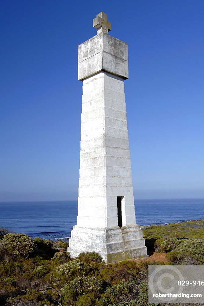
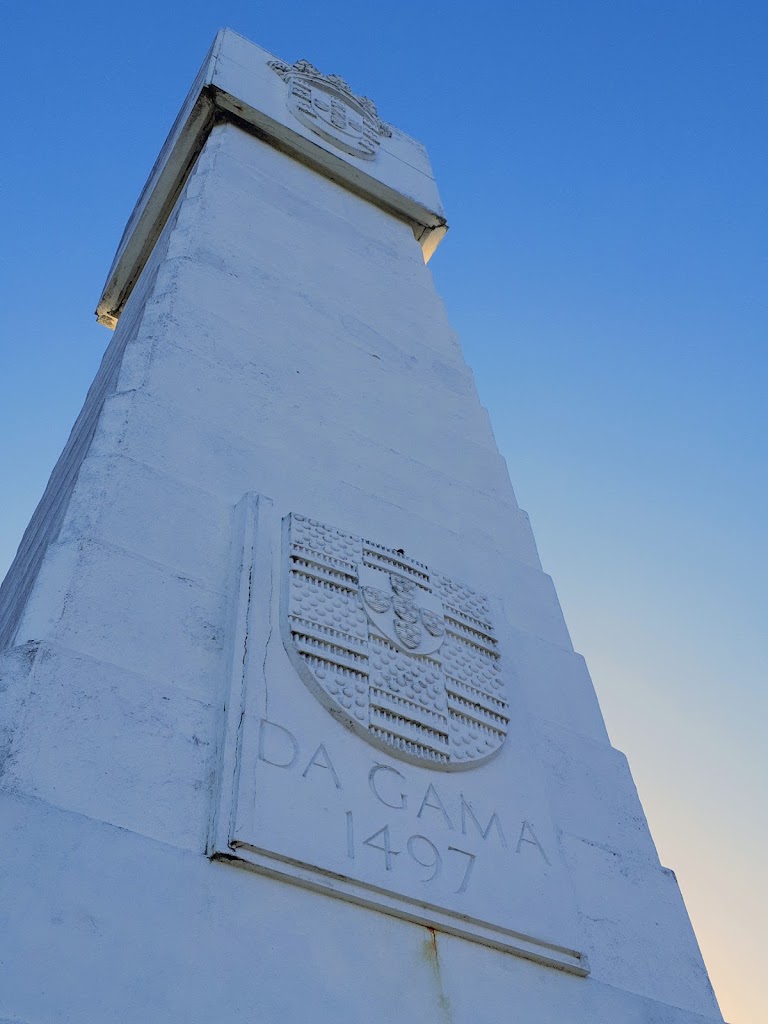
- Vasco da Gama (1497)
On July 8, 1497, Vasco da Gama set sail from Lisbon, Portugal in search of sea passage to India around the southern tip of Africa. It took him 293 days to reach Kenya on the eastern coast of Africa from Lisbon. He berthed in the friendly port of Malindi on the eastern coast of Kenya on 24 April 1498.

Gama took only 23 days to sail from Malindi to Calicut.
It may surprise you. Authentic records of voyages of Vasco da gama shows that he left Malindi, Kenya on 24 April 1498* and reached Calicut, India on 18 May 1498. He has taken 293 days to cross the Atlantic Ocean but only 23 days to navigate the bigger Indian Ocean. How was it possible ?
As the folk lore goes, at Malindi, Gama could engage the service of one Majid, a sailor from Gujrat who had the experience of 50 long years of navigating the Indian Ocean. He harnessed the south west monsoon to sail the 5000 kilometres of water only in 23 days.
Gama took 132 days to reach the cape on his return journey.
As we know, Gama was unsuccessful in securing any commercial treaty with Calicut. The court of Zamorin of Calicut was full of Arab traders. They filled the ear of the Zamorin against Gama. Zamorin turned him out. In retaliation Vasco da Gama exploded the cannons on his ship on 29 August 1498 and escaped in haste. He could journey the Cape of good hope and reach the Atlantics only on 2 January 1499. It took him 132 days. He lacked the expert navigators of India to guide him this time.
The maritime history of coastal India.
Truth be told, even 3000 years before the birth of Christ, the Indians of both Coromandel coast and Malabar coast were a fearless sea faring community and expert mariners. They were having trade relationship with the Babylonians, Assyrians and Egyptians on the west. Muziris is the nerve centre of this trade. This prosperous trade link was vibrant during the Portuguese explorations in 1498.
On the eastern sea board, Indian merchants have traded and influenced all the nations of present day South East Asia: Cambodia, Indonesia, Laos, Malaysia,Burma, Singapore, Thailand and Vietnam. It found place in record after Ashoka’s effort to spread buddhism in the places that already have trade relation with the Coromandel Coast. Bali yatra of Odisha is a distant memory. Huen sang who came from china via Tibet preferred to sail back to China from the eastern coast. Both Singapore ( City of Lion) and Sinhala ( Of Lion) names are influence of India though they don’t harbour any lions. Maritime exploits of the Cholas and the Gangas were well known on the eastern coast in the 15th century.
It is strange that these golden maritime history of India do not find a place in our ancient Epics.
Our poor maritime memory.
We have two famous Epics one is a horizontal and the other a vertical travelogue.
Mahabharat starts from Gandhara ( Afganistan), the birth place of Shakuni and Gandhari and spreads unto Manipur, where Arjuna met Chtrangada.
The geography of Ramayana gives us more details. It starts from the bank of river Saraju in UP and spreads to Prayag, goes on to Chitrakoot, MP, Dandakaranya, Panchavati ( Nasik), Kishkindha ( Hospet , Karnataka). Unfortunately, the epic lacks any description of the 1200 kms distance between Kishkindha in Karnataka to Rameshwaram on the sea.
Why don’t we have more stories like Ta’poi of Baliyatra of Odisha or Rajendra Chola’s invasion of SriVijaya empire of Indonesia.
